Geographic Feature Poster
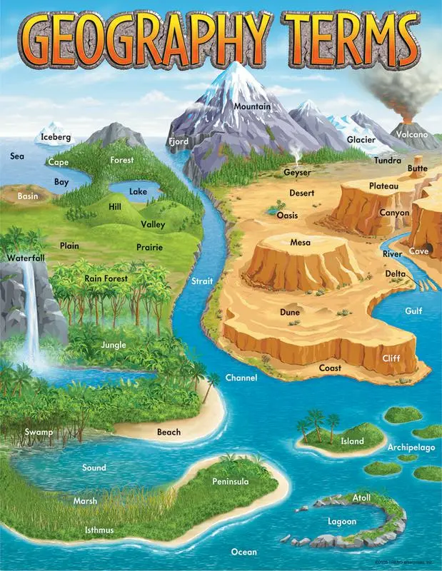 Growing up, I was always drawn to the posters, graphics, and diagrams hung up in classrooms, whether it depicted the solar system, grammar rules, mathematical equations, or a map of the world, I was intrigued. I was always drawn to one type of poster seen hanging on the wall of a social studies (or geography/science) classroom, a geographic feature poster. This educational graphic depicts a fantastical landscape where every geographic feature is labeled and features are illustrated in an exaggerated way for educational purposes. I always loved looking at posters like these, imagining a land mass that contains every biome, every feature, all within a self contained ecosystem. Obviously, nothing like this could ever exist on Earth as this planet is larger than life, biomes spanning over thousands of miles, some on opposing sides of the globe, features forming and changing over thousands of years, yet they all exist here together. Ever since I started illustrating landscapes and the natural world I always wanted to make a geographic feature poster for myself. Last year, in the summer of 2024, I illustrated several scientific posters that depicted natural cycles, celestial objects, and more. As I was gaining inspiration for another poster idea, I came across this iconic geographic feature poster, an artifact from my childhood, and I knew then and there that it was time to tackle it.
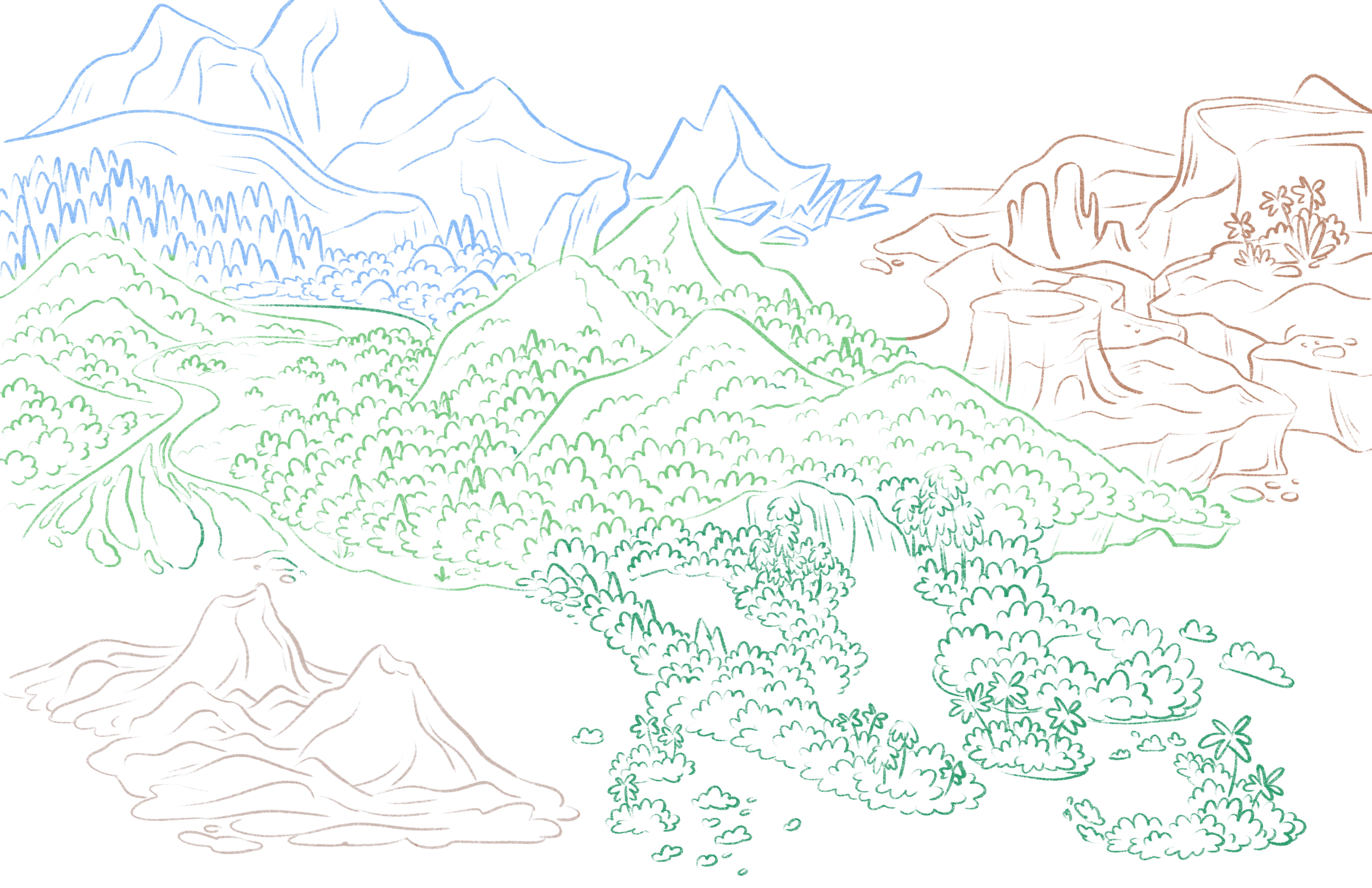 Getting the idea to make my own geographic feature poster was by far the easiest part of this project as when it came time to sketch out this exaggerated, false landscape I hit a roadblock. I gathered more inspiration from other posters and diagrams of this same idea so I wasn’t just inspired by the one poster from my childhood because the last thing I wanted to do was to blatantly recreate this one poster, I wanted it to be mine. I began to write down common geographic terms and renditions seen within these posters as well as looking elsewhere for other geographic features not seen in some of these posters. The list was long, a little daunting, but I knew that by dividing it up, and planning where some of these features would fit together, it would make this process a lot easier. I divided this list into 5 main regions: tropical (dark green), temperate (light green), desert (orange), polar (blue), and volcanic (brown). Doing it like this saved me tons of trouble down the road as I could figure out and plan where certain features would go, and optimize the space to ensure an even spread of features which will make labeling and understanding the poster a lot easier.
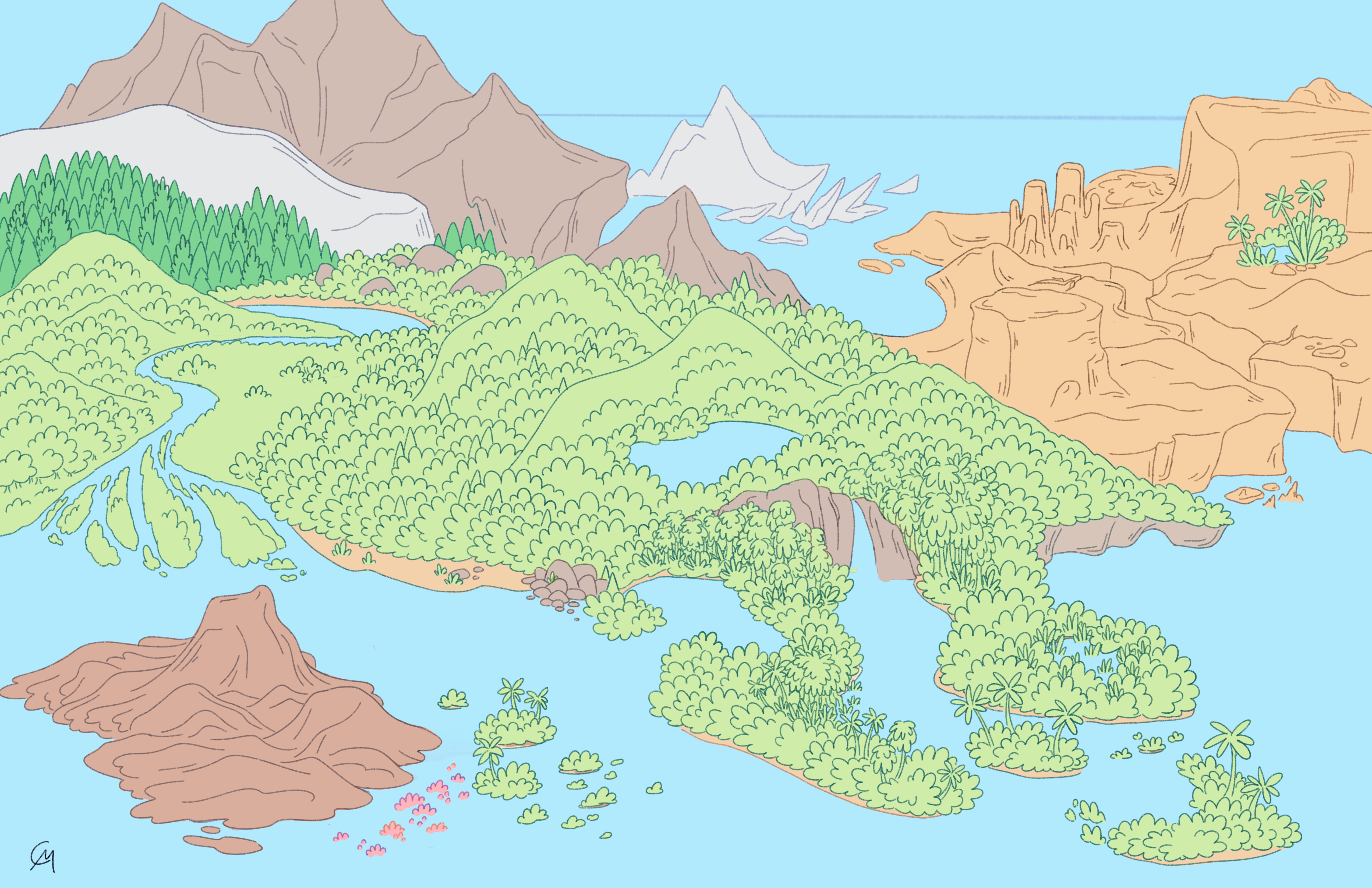 After tweaking some areas, changing where certain terms will show up, and finalizing the sketch I moved onto lineart and eventually introduced color. To be truthful, this is where I left this illustration for months before finally picking it back up this month. I wish I had finished it back then, but there is no better time than now. I started with the easier sections full of temperate and tropical forests, then moved onto the polar regions, eventually making my way into the desert. From sketch to final, the desert changed the most as I had a hard time making some features pop against the sameness of the desert, and to make more room for labeling. Another area that changed was the volcanic region within the ocean. Initially it had two volcanos, an active, and a dormant, but it ended up dominating the area and drawing the eye to the bottom left corner so I shrunk it down to one active volcano to allow more breathing room around the archipelago and coral reefs nearby. Lastly, I added a lake within the valley to add more negative space to break up the rolling hills of green in the center of the illustration.
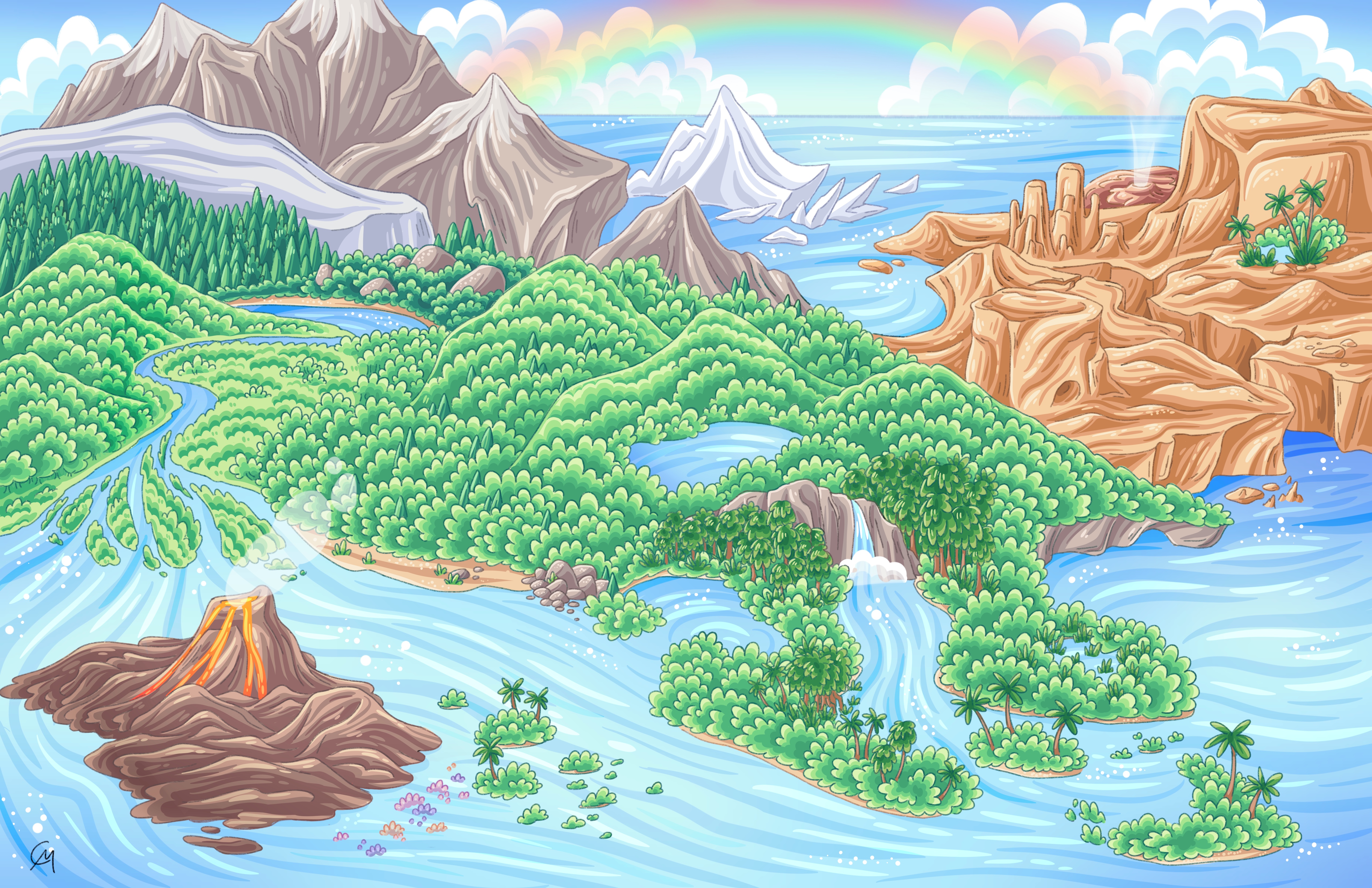 After some finishing touches, labeling the features, and adding a rainbow I finally finished my own geographic feature poster. Seeing it come to life definitely nurtured something within me, and it's a wonderful addition to my other educational poster illustrations. Doing this project has greatly inspired me to illustrate different biomes and habitats as well as dabble into maps and bird’s eye view landscapes. Overall this project taught me how to manage space, positive and negative, create a diverse yet vast landscape that blends into varying biospheres, and with it I learned more about these geographic terms, how they form, where they exist, and how they change over time.